
Chris Drabble is a writer and photographer who has found that the southern edge of Winnats Pass provides great opportunities for landscape photography and also possesses inspiring views.
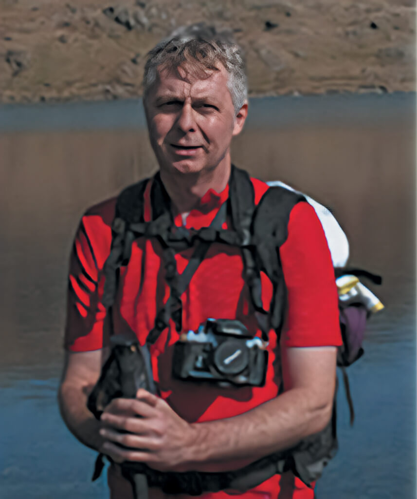
Chris Drabble
I’VE parked at the National Trust car park at Mam Nick, then pick up the tree-lined footpath that heads north-east towards Mam Tor. Upon clearing the trees, I take the first right turn, heading due south and walk downhill to reach the Chapel-en-le-Frith road and cross through at the gates. I’m now crossing the moorland on a well-laid footpath that takes me past Windy Knoll to reach the intersection at the Sparrowpit road.
On the opposite side of the road is a newly-erected wooden gate that leads out onto fields and I’m now following a diagonal, trace path across a field of sheep that leads to a wide gap between two gate posts in the wall ahead. A short walk from here reveals another new wooden gate in the drystone wall that allows entry onto ‘open access land’.
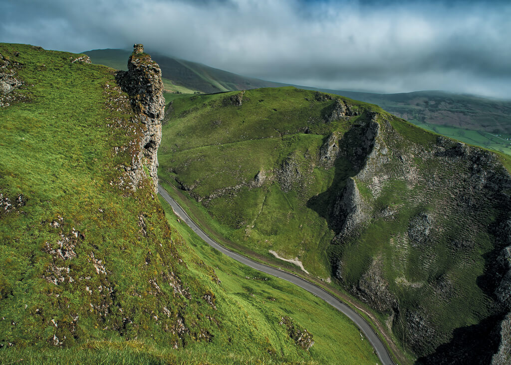
Through the gate, I turn right and I’m now walking along the steep-sided southern edge of Winnats Pass on a rough path that meanders over gently undulating ground. My destination is a limestone tower that is often referred to as the Devil’s Chimney.
I’ve reached it now and, after scouting for a fine composition, I set up the camera and tripod and take some initial photos.
THE DEVIL’S CHIMNEY
The light fades momentarily as passing clouds defuse the morning sun and as I wait for the light to return, I find a perch amongst the limestone crags and try to absorb the atmosphere of this wonderful location.
I suddenly notice a kestrel hovering beneath me. It soars on thermals and rises to eye level and, for a brief moment, it seems to be almost within touching distance. It hangs in the air and then, suddenly, it dips only to rise again and reappear a little further along the edge. It’s a moment of wonder as I marvel at this bird’s acrobatic skill.
The sound of distant voices drifting up from two cyclists who are pressing hard to gain momentum on the steep incline and then the purr of a car engine indicates activity on the road far below.
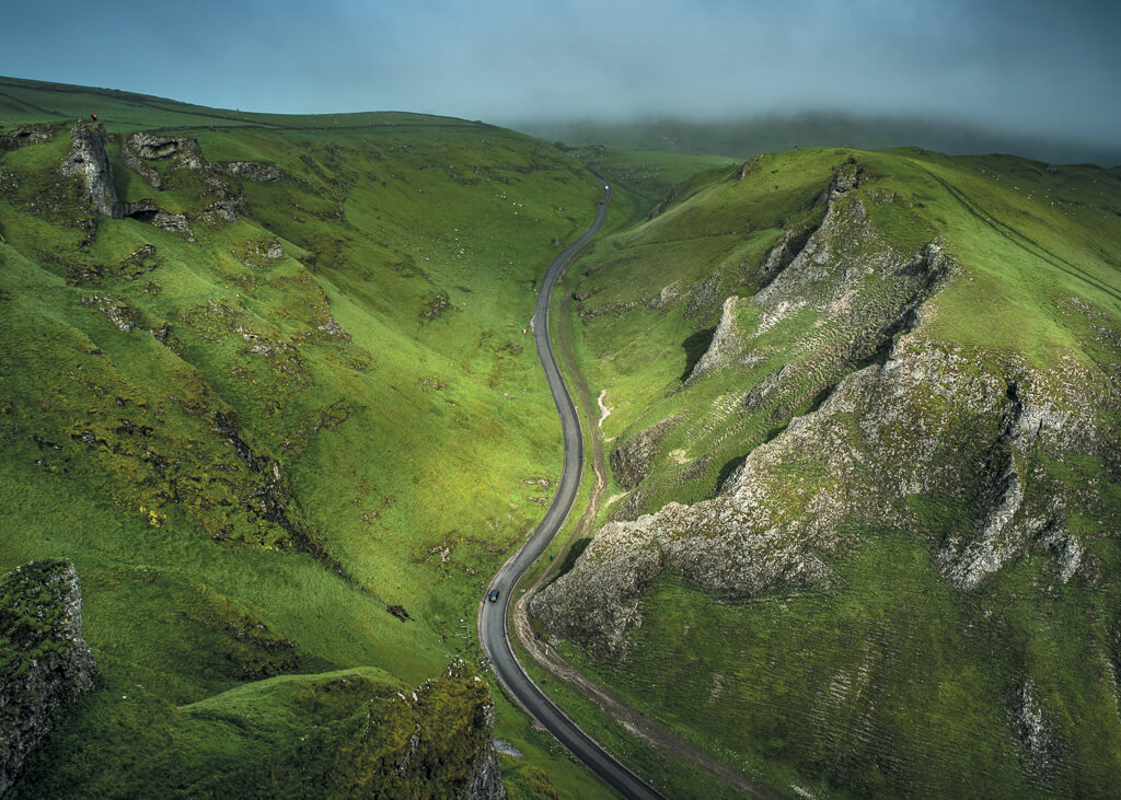
Having followed the kestrel for a while, I then look up to take in the wider view. And what a superb view it is!
Looking across and up the valley, the best of the views lie to the north, east and west.
To the north/west, the Iron and Bronze Age hill fort of Mam Tor is the most prominent feature with its great landslip and its defensive embankments. Lords Seat and Rushup Edge run west along the ridge beyond.
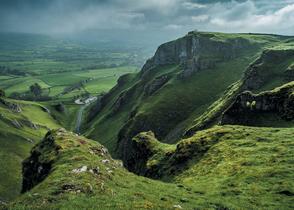
Below and on the opposite flank of the gorge are the steep limestone arêtes of Matterhorn Ridge and Elbow Ridge that rise vertically from the roadside to just below the summit ridge.
ELBOW RIDGE
To the north/east is the Peakland Ridge (also known as the Great Ridge) which extends from Mam Tor until its conclusion at Lose Hill, and in the east the pike of Win Hill can be seen breaking the horizon.
TOWARDS CASTLETON
It’s time to go, but I’m reluctant to leave this idyllic spot. I have enjoyed the time I’ve had at Winnats Pass and as always, I think that I have enjoyed the solitude as much as the photography.
I’ll definitely come back to this southern edge of Winnats Pass and I wouldn’t hesitate to recommend this wonderful spot with its superb views to anyone.
Editor’s Note: More of Chris Drabble’s photography can be found at Photo4me, Alamy and 500PX.